 |
| Aireys Inlet |
Twenty years ago we traveled the Great Ocean Road in the middle of winter from west to east in a single day as we drove from Port Fairy to Melbourne. That route included about 50 miles on either end away from the ocean. This year we decided to take three days and travel from east to west without the extra miles on the east end. The Great Ocean Road deserves the adjective applied to it. I think of it as Bryce Canyon National Park with water or the Hiway 101 in Oregon or Hiway 1 in California with color and more sea stacks.
 |
| Danger Point |
 |
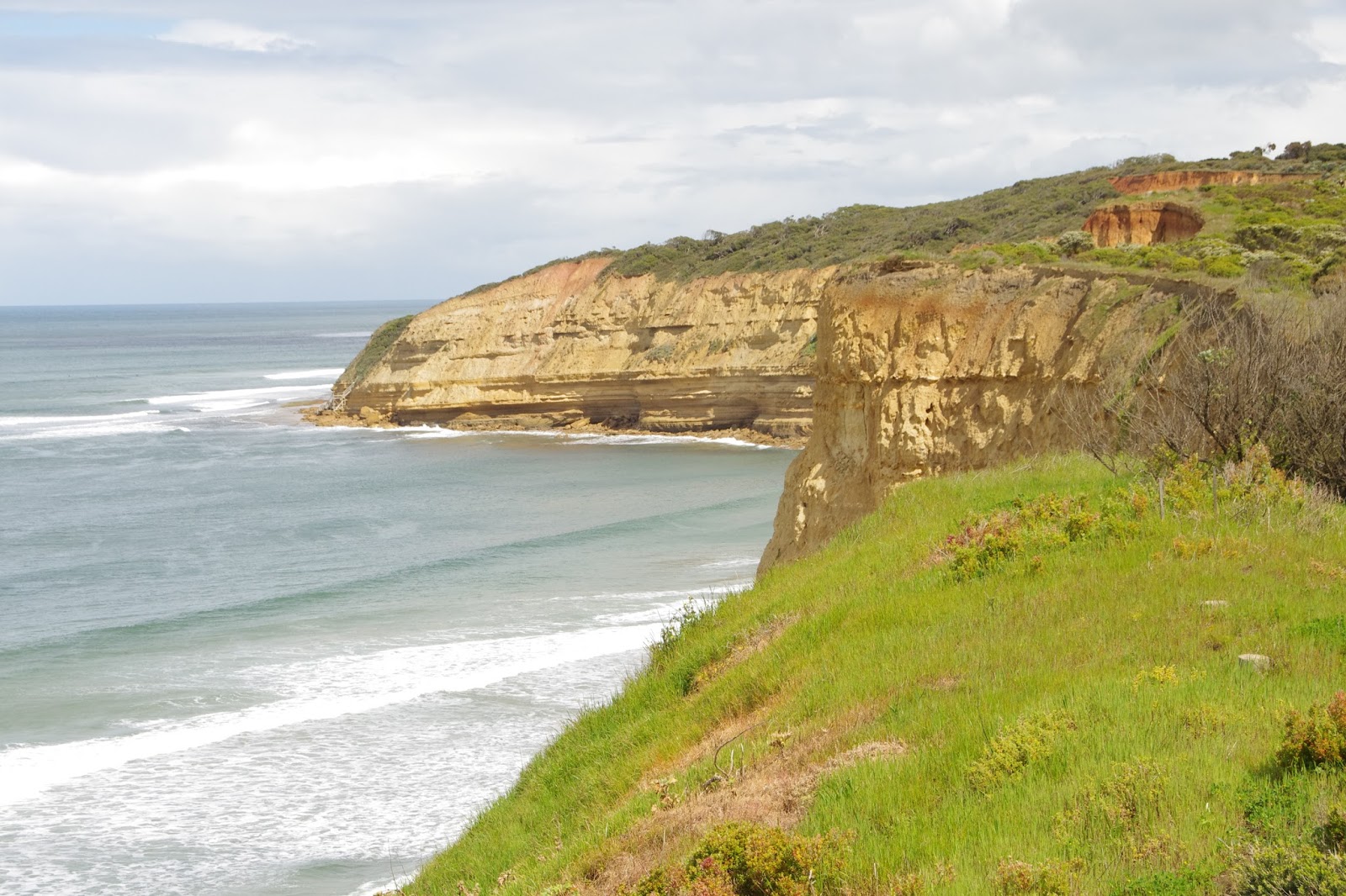
| Our first sea stack along the route. Twenty years ago we saw a mama whale with child here. |
Locals along the southern coast dreamed of a tourist route long before it actually became a reality after World War I. Even then the state and national government weren’t interested in funding the road so local governments and the Returned Services League stepped up in part create employment for soldiers back from World War I. The first section opened in 1922 between Aireys Inlet and Lorne as a one-lane, unsealed road with few guard rails. By 1934, the Victoria state government agreed to take over the funding for the road and remove the tolls. Today the road is a two-lane sealed road with guardrails as needed and passing lanes where possible. Pullouts, trails, information signs, and visitor centers complete the package for today’s drivers.
 |
| We see these war memorials everywhere. This one is at the start of the Great Ocean Road. |
We started by spending two nights at the east end of the drive in Torquay. We used that day in Torquay to drive the first 18 miles to Aireys Inlet to spend some time at the Lighthouse there. Amazingly, Google Maps has trouble directing drivers along the road. It won’t even offer the road as an option for a full-day drive. It insists on choosing the faster inland route. Nevertheless, we could use old maps and choose intermediate points to trick Google.

Torquay is the official eastern end of the road and begins with a park, overlook, and an information plaque. The park includes a memorial to ANZAC. Torquay also houses a Surfing Museum which we passed up this time.
 |
| Wikipop Beach |

We followed the coastline to Bells Beach. Bells is one of the premiers surfing sites in the world and the location of the Rip Curls Pro Bells Beach surfing competition held here since 1962 making it the longest continuously running surfing championship in the world. I spend a few minutes talking to a surfer here who said that Wikipop Beach next door offers better waves, but lacks the viewing space at Bells Beach.

  |
| Typical walkway at Urquhart Bluff |
We continued along the coast line past stops at Point Roadknight and Urquart Bluff named for an early land surveyor before reaching Aireys Inlet and the Split Point Lighthouse. We did not take advantage of the climb to the top of the lighthouse. It didn’t seem to offer much more in the way of a view and therefore not worth the price of admission.

By this time it was late afternoon so we took the faster inland route back to our condo. We had our first night dinner at Frontbeach Taphouse in Torquay. Typical American-style pub food and an excellent Pacific Coast style IPA. After our drive the next day we ate in. Linda found some excellent meat pies at the grocery store which went well with a nice bottle of local wine.


 |
| Aireys Inlet Lighthouse |
 |
| Private home near the lighhouse |


No comments:
Post a Comment